Autumn and winter are typically characterized by numerous cold fronts.
Cold fronts are not themselves actual masses of cold air, per se. Cold fronts simply are the line (or transition area) between a warmer air mass and the cooler air mass moving in.
While most cold fronts are accompanied by clouds, rain, and often severe storms, some cold fronts pass without much — if any — fanfare at all.
Here’s everything you want to know about weather cold fronts…
Wind Changes With Cold Fronts
A cold front is a boundary area between warm air and cooler air.
In most cases, you will know a cold front has passed by when the wind direction changes.
While there are exceptions, in the northern hemisphere:
- A cold front is followed by winds that trend from the north, northwest, or west.
- Winds ahead of the cold front usually come from the south, southeast, or east.
Temperature Changes Due To Cold Fronts
- A cold front in a southern region, such as Florida, may mean a temperature drop of 5-10 degrees during the early autumn.
- A cold front passing through the Midwest and northeast during the same period can mean a temperature drop of 10-15 degrees or more.
- Some cold fronts can bring dramatic temperature changes of 20-35 degrees difference or more over the course of just 24 hours.
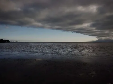
Weather Changes During Cold Fronts
While the air-mass behind the cold front is the actual area of cold weather itself, the cold front is the zone of changing weather.
A weather front is a boundary separating 2 masses of air of different densities, and is the principal cause of meteorological phenomena. In surface weather analyses, fronts are depicted using various colored lines and symbols, depending on the type of front.
~ Source
Because of the varying temperatures of the 2 air masses and the opposing wind directions which usually do battle at the boundary area of the cold front itself, clouds, rains, and storms are typical. In fact, some cold fronts can produce hail, tornadoes, and (during the winter) terrible snow storms.
Other common cold front weather changes involve elevated wind speeds and dropping dew points as the front passes. Barometric pressure can drop as a cold front moves in, then rise after the front has left the area.
Duration Of Cold Fronts
While cold front storms sometimes have the potential to be violent, they don’t usually last long in any one area.
Why? Because the storms which accompany a cold front often form in long, narrow bands.
While a single cold front may produce a squall stretching from New York to Florida, the line of storms may take less than a couple hours to clear the cities and towns it passes through.
Cold front storms may out run (be ahead of) a cold front by more than 100 miles.
Backdoor Cold Fronts
Have you ever heard of a backdoor cold front?
Back door cold fronts are so-called because they tend to enter a region from the direction opposite that of most cold fronts.
While a typical cold front will advance from west to east, northwest to southeast, or north to south, a backdoor cold front will come in from the northeast or east.
Many backdoor cold fronts move cool, ocean air over warmer land regions.
How Cold Fronts Look On A Map
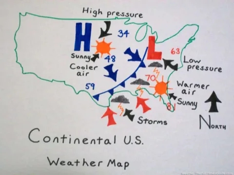
A cold front is easy to find on most weather maps. They are represented by a blue line with triangles popping off the right side of the blue line.
The “L” you will see associated with cold fronts is an area of low pressure. Low pressure usually brings stormy weather.
In the northern hemisphere, the winds coming off the western side of a low pressure system can draw cooler winds from the north and northwest.
High pressure (an “H” you will find behind a cold front on a weather map) is an area of calmer weather. In the northern hemisphere, the eastern side of an area of high pressure can draw down cool weather from the north and west.
More about cold fronts.
A Word About Warm Fronts…
Warm fronts mark the boundary between a cool air mass and a mass of advancing warm air.
On a weather map, the warm front is usually depicted as a red line with red semi-circles.
- The warm front (the boundary itself) often brings stormy weather.
- The weather behind a warm front can quickly turn hot and humid.
Yep, warm fronts bring heat and humidity!


