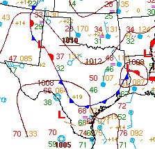
 Gee whiz that weather map looks cool.
Ever wonder what all of those numbers and symbols mean?
Here are the answers!
When we show you weather maps on television, we usually show you one element at a time. It might be current temperatures, or maybe cloud cover, or maybe rainfall.
As meteorologists, though, we look at one map to get all of that information and a lot more.
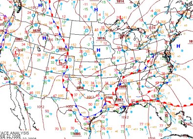
We can find cold fronts, warm fronts, clouds, rain, fog, strong winds and more just by looking at a basic "surface chart."
The surface chart is a lot easier to understand than it looks.
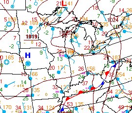
Let’s zoom in on a small part of the country so you can see the symbols a little bit better. Let’s focus, for a moment, on Cincinnati, Ohio. That’s the "station plot" in the Southwest corner of Ohio. You see a circle with numbers around it. Everything there has meaning.
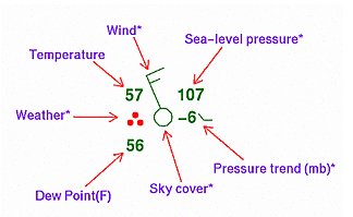
As you can see in this key, the top left number is the current temperature, the bottom left is the Dew Point etc. To understand the rest of the funny looking symbols, you can go to the NOAA website.
So, scroll back up to the midwest map. What’s the temperature in Cincinnati? What’s the Dew Point? Is it cloudy or clear? The wind direction? What’s happening in Chicago? (Answers below.)
Here’s the Hydrometeorological Prediction Center’s daily weather map. Spend a little time on the HPC’s site and you’ll become familiar with surface weather maps in a hurry!
OK, now to answer the weather map questions above… Cincinnati’s temp is 26 degrees, dew point 24 degrees, it’s cloudy with a wind from the East at about 5 mph. Chicago has light snow and 21 degrees with a wind from the Southeast at 10mph.
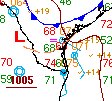 Finally, my local chamber of commerce insists that I show you this map… a close-up of my neighborhood in South Texas. This station plot is at the exact same time as the ones above for Chicago and Cincinnati.
The temperature in Brownsville? Yup. 74 degrees – at 10:30 in the evening. Check with your travel agent for flights to Brownsville, Harlingen and McAllen!

